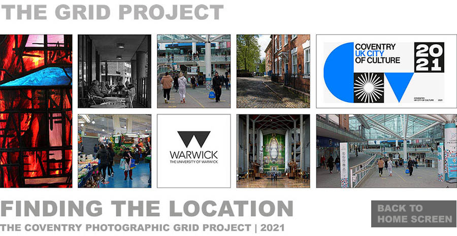
In addition to the detailed map, this list gives an approximate description of each location. The red buttons link to online maps (what3words) which show the centre of the grid circle.

© Dave Allen 2021
|
|||
|
In addition to the detailed map, this list gives an approximate description of each location. The red buttons link to online maps (what3words) which show the centre of the grid circle.
|
|||
| 1A | City Point Student Accommodation | |
|
| 1B | Salvation Army, Upper Well Street | |
|
| 1C | Harrabin Construction, Chapel Street | |
|
| 1D | Study Inn, off Chapel Street | |
|
| 1E | Grassed area, Bishop Street | |
|
| 1F | Car park, Silver Street | |
|
| 1G | Coventry Transport Museum | |
|
| 1H | Lady Herbert's Gardens | |
|
| 1I | White Street / Bus Station | |
|
| 1J | Entry ramp, Ringway Swanswell | |
|
| 1K | Car park under Ringway Whitefriars | |
|
| 2A | City Village (Downing Students) | |
|
| 2B | Belgrade Square | |
|
| 2C | Coventry Evening Telegraph Building | |
|
| 2D | Corporation Street, Study Inn | |
|
| 2E | Corporation Street, The Philip Larkin Pub | |
|
| 2F | Palmer Lane | |
|
| 2G | Hales Street, near Nisa Building | |
|
| 2H | Hales Street, Internet Cafe | |
|
| 2I | Pool Meadow Bus Station | |
|
| 2J | Pool Meadow Bus Station | |
|
| 2K | Ford Street, near Ringway exit slip road | |
|
| 3A | Bond Street, Town Wall Tavern | |
|
| 3B | The Belgrade Theatre | |
|
| 3C | Corporation Street, opposite Belgrade Square | |
|
| 3D | West Orchards, behind former Debenhams | |
|
| 3E | West Orchard Way, behind McDonald's | |
|
| 3F | Palmer Lane | |
|
| 3G | Trinity Street | |
|
| 3H | Square by BBC Coventry / Warwickshire | |
|
| 3I | Fairfax Street, under Britannia Hotel | |
|
| 3J | Fairfax Street / Priory Street junction | |
|
| 3K | Off Fairfax Street, next to Code building | |
|
| 4A | Hill Street, grassed area opposite church | |
|
| 4B | Corporation Street, near Jaguar pub | |
|
| 4C | Greggs, Smithford Way | |
|
| 4D | Inside West Orchards shopping centre | |
|
| 4E | Cross Cheaping, near West Orchards entrance | |
|
| 4F | Ironmonger Row | |
|
| 4G | Priory Gardens / Old Bluecoat School | |
|
| 4H | Grassed area, by Priory Undercroft | |
|
| 4I | Coventry Cathedral, north end | |
|
| 4J | Off Priory Street, near Priory Hall | |
|
| 4K | Coventry Sports and Leisure Centre | |
|
| 5A | Fleet Street / Corporation Street junction | |
|
| 5B | Lower Precinct shops | |
|
| 5C | Waterstone's, Smithford Way | |
|
| 5D | Upper Precinct, M&S, JD Sports | |
|
| 5E | Shops, Upper Precinct / Broadgate | |
|
| 5F | Broadgate, Primark | |
|
| 5G | Holy Trinity Church | |
|
| 5H | Graveyard, Cuckoo Lane | |
|
| 5I | Coventry Cathedral | |
|
| 5J | Priory Building, University students union | |
|
| 5K | George Eliot building, Coventry University | |
|
| 6A | Queen Victoria Road, opposite The Town Crier | |
|
| 6B | Lower Precinct shops | |
|
| 6C | Market Way (Max Speilmann / Phones4U) | |
|
| 6D | The Precinct (Costa Coffee) | |
|
| 6E | Shops, Broadgate | |
|
| 6F | Broadgate, shops, near Godiva statue | |
|
| 6G | Pepper lane, near parking spaces | |
|
| 6H | Bayley Lane, near cathedral ruins | |
|
| 6I | Bayley Lane, near Charred Cross | |
|
| 6J | University Square, near Herbert Gallery | |
|
| 6K | Edible Garden, near George Eliot Building | |
|
| 7A | Between car park and Retail Market | |
|
| 7B | Inside Retail Market, north side | |
|
| 7C | Market Way (Halifax Bank) | |
|
| 7D | Barracks Way, car park | |
|
| 7E | Hertford Street, shops | |
|
| 7F | Greyfriars Lane | |
|
| 7G | Off High Street, Courtyard pub | |
|
| 7H | Coventry City Council, Earl Street | |
|
| 7I | Saint Mary Street, Drapers Bar | |
|
| 7J | The Herbert Gallery and Museum | |
|
| 7K | Off Jordan Well, The Hub | |
|
| 8A | Rover Road, Iceland | |
|
| 8B | Retail Market, south side | |
|
| 8C | Market Way (Tesco) | |
|
| 8D | Barracks Way, car park | |
|
| 8E | Hertford Street, Poundland | |
|
| 8F | Car park entrance by Ford's Hospital Building | |
|
| 8G | Salt Lane, car park entrance | |
|
| 8H | Grassed area, Little Park Street | |
|
| 8I | Site off Earl Street | |
|
| 8J | Much Park Street | |
|
| 8K | Richard Crossman Building, Jordan Well | |
|
| 9A | City Arcade, car park | |
|
| 9B | City Arcade | |
|
| 9C | Shops off Bull Yard | |
|
| 9D | The Phoenix, near Methodist Central Hall | |
|
| 9E | Near The Wave, off Warwick Lane | |
|
| 9F | Shrub Walk, by Telephone Exchange | |
|
| 9G | Shrub Walk, near Salt Lane | |
|
| 9H | Magistrates Court / Salt Lane car park | |
|
| 9I | Between Court buildings, off St. John's Street | |
|
| 9J | Much Park Street, outside Court, grassed area | |
|
| 9K | Sir John Laing Building, Much Park Street | |
|
|
© Dave Allen 2021 |
|||
|
|
|||